
Surveying, which is often the first course of action before a project begins, establishes land boundaries, right-of-ways, and topography. ASN utilizes the latest survey tools and equipment, including GPS and both robotic and conventional total stations, to provide accuracy in survey measurement and to ensure that your projects are compatible with the boundaries and opographical conditions of the area. AVN’s surveying services are also supported by in-house GIS technicians and mappers. Our surveying and mapping teams work with a diverse group of clients, including oil and gas companies, private developers, municipalities, and state agencies. AVN’s project delivery team can facilitate and manage your entire project, eliminating multiple points of contact that delay your time to market.
PT. AVN – we help companies to grow-up their business. We build the Trust & grow together.

Survey for Land, Oil & Gas Construction scopes
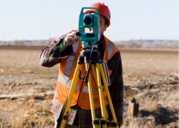
Land Survey
Mapping projects in support of planning, engineering and design are implemented and completed by our professional’s surveyors.
Read More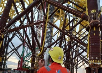
Dimensional Control Surveying
AVN have provided a dimensional control service to the petrochemical industry, both onshore & offshore.
Read More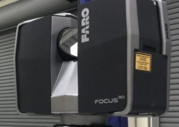
3D Laser Scanning
AVN use the latest laser scanning instruments which collect millions of measurements in three dimensions (x, y, z) called point clouds.
Read More