
Arina Veritas Nusantara (AVN) provides Mapping projects in support of planning, engineering and design are implemented and completed by our professional’s surveyors which decades of experience in land surveying.
- Topographic Survey
- Mining Survey
- Stockpile Volume Survey
- Construction Survey
- Pipeline Survey
- Geodetic Control Network
- Deformation / Slope Stability Monitoring
- Aerial Terrain Mapping
- Disaster Site Mapping
PT. AVN – we help companies to grow-up their business. We build the Trust & grow together.
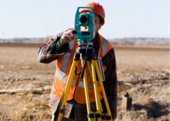
Land Survey
We provides professional Land Survey
Mapping projects in support of planning, engineering and design are implemented and completed by our professional’s surveyors.
survey for land, oil & gas construction scopes
Land Survey
Mapping projects in support of planning, engineering and design are implemented and completed by our professional’s surveyors.
Read More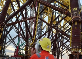
Dimensional Control Surveying
AVN have provided a dimensional control service to the petrochemical industry, both onshore & offshore.
Read More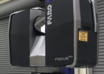
3D Laser Scanning
AVN use the latest laser scanning instruments which collect millions of measurements in three dimensions (x, y, z) called point clouds.
Read More